
GPS vs GLONASS vs Galileo: Which Is Most Accurate?

Key Takeaways
-
01
GPS is one GNSS system while GNSS includes multiple satellite navigation systems worldwide.
-
02
Multi-GNSS receivers can combine signals from several constellations for more positioning options available.
-
03
GNSS accuracy depends on receiver quality and satellite geometry in real-world tracking conditions.
-
04
Buildings and trees can weaken GNSS signals and reduce positioning reliability in difficult environments.
-
05
Modern trackers often support GPS GLONASS and Galileo together for broader satellite coverage.
Find the tracker that fits what you own.
Shop GPS TrackersAffiliate Disclosure: We earn a commission on purchases made through Amazon links on this page.
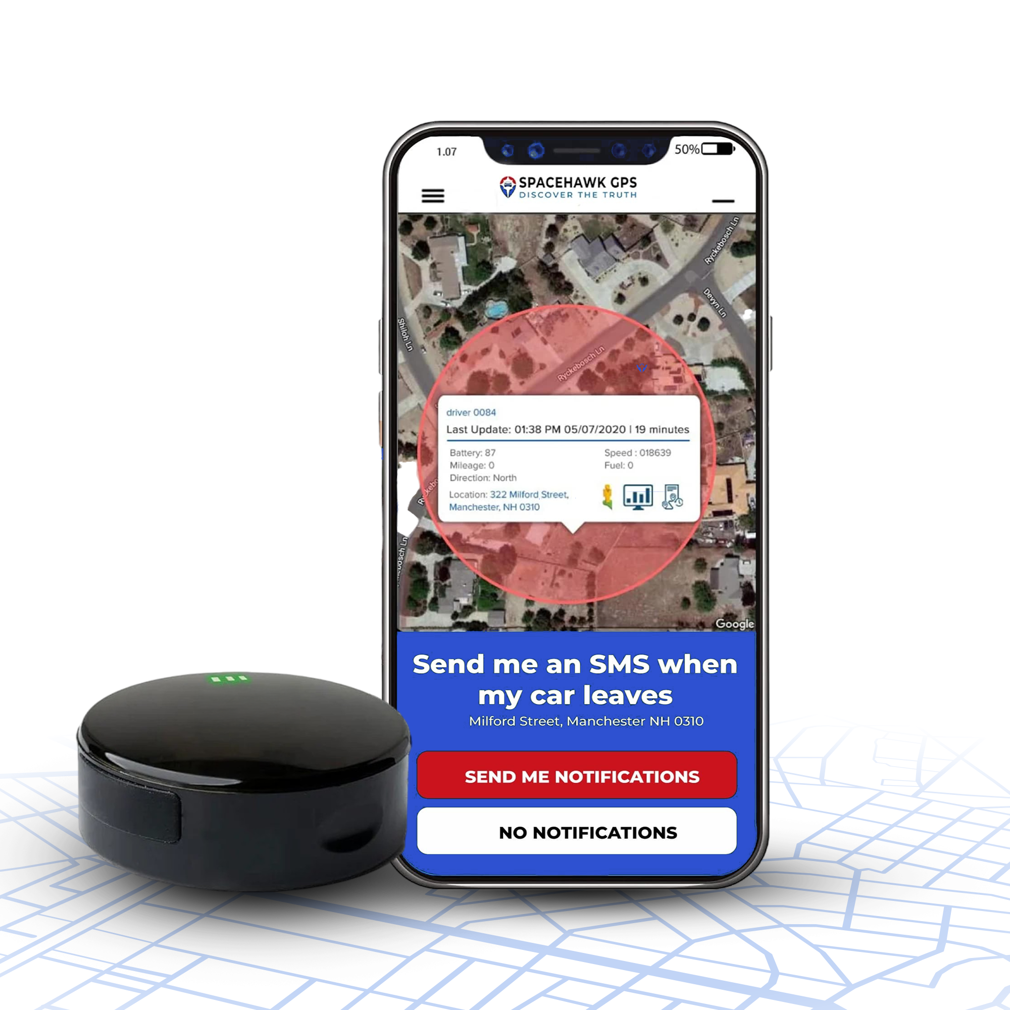
Track What You Own. Live, On Your Phone.
The SpaceHawk GPS puts a real receiver on your vehicle. Roughly six feet of accuracy, magnetic mount, lifetime warranty.
GPS vs GLONASS vs Galileo: How the GNSS Systems Compare
Comparing a GPS tracker, phone, or fleet device brings up GPS vs GLONASS vs Galileo. The comparison can quickly turn into a list of satellite numbers and technical terms. The real question is simpler.
Which system can give your device the reliable location data you need?
I’ve spent more than 15 years working around GPS tracking, construction equipment, rental fleets, and real job sites. I’ve seen how easy it is to focus on the satellite system name and overlook the other factors that affect the position a tracker reports.
A better comparison starts with how the whole system works.
This guide breaks down GPS, GLONASS, and Galileo in plain English. The guide then looks at their accuracy, coverage, signals, and use in modern trackers. You’ll also see why combining multiple GNSS systems can help a device maintain a better position when conditions get difficult.
By the end, you’ll know what to look for beyond the GPS label when choosing a tracker.
GPS vs GLONASS vs Galileo at a Glance
GPS, GLONASS, and Galileo are three separate global satellite navigation systems, and this quick comparison shows how they line up. All three provide positioning, navigation, and timing. Modern receivers can combine signals from several systems instead of sticking with one.

| Feature | GPS | GLONASS | Galileo |
|---|---|---|---|
| Full Name | Global Positioning System | Global Navigation Satellite System | Galileo |
| Primary Operator | United States (U.S. Space Force) | Russia (Roscosmos program, military-run satellites) | European Union (services run by EUSPA) |
| Global Service Since | 1995 | 1995, restored in 2011 | December 2016 (initial services) |
| Satellites in Service (Sept. 2026) | 32 | 24 | 28 |
| Coverage | Global | Global | Global |
| Main Use | Positioning, navigation, timing | Positioning, navigation, timing | Positioning, navigation, timing |
| Civilian Access | Yes | Yes | Yes |
| Works With Other GNSS | Yes | Yes | Yes |
| Practical Role | Widely supported baseline | Adds another satellite constellation | Adds another global constellation with modern civil services |
The basic distinction is simple. GPS is one global navigation system, GLONASS is another, and Galileo is another. GNSS is the broader term covering these systems and others such as BeiDou.
For tracking, I would not choose a device simply because its specification sheet mentions one familiar name. A receiver that supports multiple satellite constellations can use more signals when conditions allow. The positioning system gets more information to work with.
More signals can help.
Satellite coverage alone still won't tell you how a tracker will perform. Buildings, trees, terrain, antenna placement, receiver design, and satellite geometry can all change the position your device reports.
Before comparing individual systems, it helps to clear up the most basic question. What does GNSS actually mean?
What Is a Global Navigation Satellite System?
GNSS stands for Global Navigation Satellite System. The term covers satellite systems that provide positioning, navigation, and timing services worldwide. GPS, GLONASS, Galileo, and BeiDou are all GNSS systems. Each uses its own satellite constellation, while compatible receivers can use their signals to calculate a location.

Count them up, and roughly 130 satellites are working across those four global systems as of September 2026. The total breaks down to 32 GPS, 24 GLONASS, 28 Galileo, and about 45 BeiDou satellites.
Think of GNSS as the larger family. Simple enough.
Is GPS the Same as GNSS?
No. GPS is one GNSS. GPS stands for Global Positioning System and refers specifically to the U.S. satellite navigation system. GNSS is the wider category that includes GPS along with other global systems such as GLONASS, Galileo, and BeiDou.
People often say "GPS" as shorthand for all GNSS technology. Technically, though, GPS is one system within GNSS.
How Do GNSS Satellites Determine Location?
The basic idea is straightforward. Satellites broadcast signals containing precise timing and information about their position. Your receiver measures when those signals arrive and uses the timing difference to estimate how far away each satellite is.

Then the geometry takes over.
A receiver uses signals from multiple satellites to calculate its position and account for its own clock error. A full position and time solution commonly uses at least four satellites.
The process looks roughly like this.
More usable satellite signals give the receiver more information to work with. The quality of those signals and their position across the sky also affect the result.
Related deep guide
How Do GPS Trackers Work?
The full journey from satellite signal to the dot on your phone, explained in plain English.
Read the GuideKeep that in mind as we compare GPS, GLONASS, and Galileo under real-world conditions.
Exploring GPS, GLONASS, and Galileo
GPS, GLONASS, and Galileo are separate global satellite navigation systems with different operators, constellations, signals, and orbital designs. For tracking, the receiver's ability to use multiple systems can be more important than the name printed on the device.

What does each system bring to the table?
1. GPS (Global Positioning System)
GPS is the U.S. Global Positioning System, providing positioning, navigation, and timing services worldwide. The United States Department of Defense developed GPS to meet military and national security needs. U.S. Air Force Space Command declared full operational capability on April 27, 1995, with 24 satellites. Today the U.S. Space Force runs a constellation of 32 active satellites. The final GPS III launch came in April 2026.
The system includes satellites, ground control infrastructure, and user equipment. User equipment means the receiver inside a phone, vehicle navigation unit, or GPS tracker.

GPS still serves military applications too. The newest GPS III satellites carry M-code. The Space Force describes it as three times more accurate and eight times more resistant to jamming.
For everyday users, GPS is the name most people recognize.
A GPS receiver uses signals from the satellites to calculate your position, speed, and time. Modern devices can also combine GPS signals with other GNSS constellations. A tracker or phone does not necessarily rely on GPS alone.
2. Galileo
The Galileo system is the European Union's global satellite navigation system, designed as a civilian-controlled system with worldwide positioning services. The EU owns Galileo, the European Commission manages the program, EUSPA runs the services, and ESA handles system design.
Galileo Initial Services started on December 15, 2016, and the first performance report found 11 satellites operating in early 2017. The design calls for 30 satellites in Medium Earth Orbit, 24 active plus six spares, and 28 are operational today.

Galileo also offers services beyond its basic open positioning service, including its High Accuracy Service and Search and Rescue capabilities. Galileo's advanced technology includes passive hydrogen maser and rubidium atomic clocks. Its independent civilian architecture sets it apart from GPS and GLONASS, which both have military roots.
A few features are particularly relevant for tracking.
- Global coverage for compatible receivers.
- Multiple navigation signals across different frequency bands.
- High Accuracy Service for supported high-precision receivers.
- Search and Rescue support that relays distress beacon alerts.
The practical takeaway is straightforward. A device that supports Galileo gets another global constellation alongside GPS and GLONASS. The receiver gets more signals and better geometry to work with.
3. GLONASS
GLONASS is Russia's global navigation satellite system. Roscosmos coordinates the program, while Russia's military space forces operate the satellites. Between 2011 and 2015, that job sat with the Russian Aerospace Defence Forces, which then merged into today's Aerospace Forces.

Like GPS, GLONASS provides satellite-based positioning and timing information that compatible receivers can use to determine location. GLONASS first reached 24 operational satellites in December 1995. Funding cuts then left just six working satellites by 2001, and Russia restored the full 24-satellite constellation in October 2011.
Roscosmos listed 24 operational satellites plus 2 in commissioning as of March 2024.
One useful point for tracking is its unique orbital configuration. GLONASS uses a different constellation arrangement from GPS, so the satellites are not simply duplicates of the same coverage pattern.
The difference can help a multi-GNSS receiver get a broader set of signals to work with.
Which Is More Accurate, GPS, GLONASS, or Galileo?
There is no single accuracy winner in the GPS vs GLONASS vs Galileo comparison. Real-world positioning depends on the receiver, satellite geometry, signal quality, and environment. Correction services and multiple frequencies also change the result.
The published numbers need some context too.

GPS Accuracy
GPS can provide highly accurate positioning, but the result depends heavily on the equipment receiving the signals.
4.9 meters
Typical smartphone GPS accuracy under open-sky conditions. Dual-frequency receivers and augmentation systems can achieve much higher precision.
For everyday tracking, the receiver makes a major difference. Receiver type, signal conditions, and available corrections all affect the final position. Comparing a basic GPS tracker with a professional receiver using one accuracy number can give you the wrong impression.
GLONASS Accuracy
GLONASS also provides global positioning, but a simple accuracy number is difficult to assign to every GLONASS-enabled device. You'll often see GLONASS quoted at about 2 meters, or at 2 to 7 meters for civilian use.
The official picture is a little different. Roscosmos lists the GLONASS Open Service accuracy at 5.6 meters. ESA's Navipedia rates GLONASS as slightly less accurate than GPS on its own. The receiver, satellite geometry, atmospheric conditions, and local obstructions all influence the final position.
GLONASS can also work alongside other constellations.
A compatible receiver may combine GLONASS signals with GPS, Galileo, and other GNSS signals. The position rarely comes from GLONASS alone.
Galileo Accuracy
Galileo's Open Service is designed to provide global positioning and timing for compatible receivers. EUSPA commits to 2-meter horizontal accuracy for the Open Service and says actual performance runs between 1 and 2 meters.
Galileo also offers a separate High Accuracy Service. The service targets 20 cm horizontal and 40 cm vertical accuracy for free with suitably equipped receivers. The service is still in its initial phase, and phones and most trackers don't use it. EUSPA points that enhanced accuracy at precision agriculture, surveying, and drone navigation. Road-safety technology and emerging systems such as autonomous vehicles are on the list too.
The 20 cm figure should not be compared directly with a typical smartphone result. The equipment and the service are different.
Why Accuracy Numbers Can Mislead
A number such as "1 meter accuracy" sounds precise. The figure does not tell you how a particular tracker will perform in your vehicle, yard, city, or job site.
Keep these differences in mind.
- Signal accuracy describes the quality of the navigation signals.
- Receiver accuracy describes how well the device calculates a position from those signals.
- Correction services can improve positioning substantially.
- Satellite geometry affects how well the receiver can calculate its location.
- Buildings, trees, terrain, and reflected signals can reduce accuracy.
I would look at the complete receiver rather than one accuracy figure when comparing GPS, GLONASS, and Galileo. The constellation is only one part of the positioning system.
Which GNSS System Has Better Global Coverage?
GPS, GLONASS, and Galileo are all global navigation satellite systems designed to provide worldwide coverage. Their coverage is global, but constellation design and satellite geometry can affect what a receiver sees in a particular location.

- GPS Coverage: GPS provides positioning and navigation services through a constellation arranged to maintain broad coverage across the globe.
- GLONASS Coverage: GLONASS also provides full global coverage. The orbital arrangement provides useful satellite visibility at higher northern latitudes, which can strengthen satellite geometry there.
- Galileo Coverage: Galileo provides worldwide positioning under the European Union's space program. Extra services cover high-accuracy positioning and search and rescue.
What Does Global Coverage Actually Mean?
Global coverage does not mean a receiver will have the same satellite visibility or positioning performance everywhere. Open sky gives broad visibility, and buildings and terrain block parts of the sky. Receiver design decides which systems and signals a device can use.
The more useful question for a tracker is how well its receiver can use those systems where the device operates.
How Do GPS, GLONASS, and Galileo Differ in Satellite Orbits?
GPS, GLONASS, and Galileo all use Medium Earth Orbit (MEO) satellites, but their orbital layouts are not identical. The number of orbital planes, altitude, and inclination shape where satellites appear in the sky. They also decide how consistently a receiver can use them.

GPS Orbital Design
GPS satellites orbit about 20,200 km above Earth and are arranged across six orbital planes. The planes are inclined about 55 degrees to the equator, creating broad coverage around the planet.
GLONASS Orbital Design
GLONASS uses a different orbital arrangement. Satellites sit across three orbital planes at about 19,100 km altitude and an inclination of roughly 64.8 degrees.
The higher inclination gives GLONASS useful visibility at higher northern latitudes, which can improve satellite geometry for receivers up there. The orbital position of each plane also gives receivers a different satellite geometry compared with GPS.
Galileo Orbital Design
Galileo also uses three orbital planes, but its satellites operate higher, at about 23,222 km altitude, with a 56-degree inclination. The constellation is designed for broad global visibility, including good coverage at higher latitudes.
Why Does Orbital Geometry Affect Positioning?
Satellite position across the sky can influence how well a receiver calculates a location. A wider spread of usable satellites generally provides stronger positioning geometry than satellites clustered in one part of the sky.
For everyday tracking, these differences are one reason multi-GNSS support can be useful. A receiver can combine usable signals from several constellations instead of depending on the satellite geometry of one system alone.
How Do GPS, GLONASS, and Galileo Differ in Signals?
GPS, GLONASS, and Galileo use different signal structures and frequency combinations. Receiver support for those signals can affect positioning performance. The effect grows when a device can use more than one frequency or constellation.

Signal Frequencies
Each GNSS constellation broadcasts navigation signals across specific frequency bands. GPS uses signals such as L1 and L5, and Galileo uses signals including E1 and E5. GLONASS uses its own signal structure.
Receivers need compatible hardware to process those signals.
Multiple-Frequency Support
Multiple-frequency receivers can use measurements from more than one frequency to reduce certain positioning errors. The ionosphere causes many of those errors.
Multiple-frequency support brings three common benefits.
- Better correction of ionospheric errors.
- Support for higher-precision positioning.
- More information for advanced positioning calculations.
Multiple frequencies still don't guarantee high accuracy on their own.
Receiver Compatibility
A tracker labeled "GPS" may support only GPS signals. A multi-GNSS receiver may also support GLONASS, Galileo, BeiDou, and additional signals. The actual receiver specifications give you a clearer picture than the GNSS label alone.
Why Is Signal Support Important?
Signal support affects how much positioning information a device can use. A compatible receiver may have access to more satellites, more frequency measurements, and more options. That margin helps when some signals are blocked or hit by signal interference.
For tracking applications, that can mean more reliable positioning as conditions change.
Which GNSS System Is Best Supported by Modern Devices?

Modern phones, vehicles, watches, and tracking devices commonly support more than one GNSS constellation. GPS has broad device support, while GLONASS and Galileo are also widely included in modern multi-GNSS receivers.
- GPS Support: GPS has been built into smartphones, navigation devices, vehicle equipment, and GPS trackers for decades.
- GLONASS Support: Many multi-GNSS receivers include GLONASS and use it alongside GPS.
- Galileo Support: Galileo has become a standard part of many newer GNSS chipsets and devices.
- Multi-GNSS Receivers: One receiver can use several constellations together. The positioning engine gets a larger pool of signals to evaluate.
What Should You Check Before Choosing a Tracker?
For a GPS tracker, the satellite-system label is only one part of the specification. I would check the complete positioning and connectivity setup before choosing a device.
Look for these details on the spec sheet.
- Supported GNSS constellations.
- Supported frequencies and signals.
- Single- or dual-frequency capability.
- Antenna design and placement requirements.
- Cellular network compatibility.
- Positioning features suited to your operating environment.
Broader GNSS support gives a tracker more positioning options, but good tracking depends on the whole package. Our top 10 GPS trackers roundup shows how complete devices compare on exactly that basis.
What Affects GNSS Accuracy in the Real World?
GNSS accuracy depends on satellite geometry, signal conditions, receiver quality, antenna design, and the surrounding environment. Buildings, trees, terrain, reflected signals, and positioning methods can all affect the location a device reports.

Nine factors do most of the work.
Stop Reading Specs. Start Tracking.
All nine factors above come down to one dot on a map. SpaceHawk puts that dot on your own vehicle today.
Why Do Modern Devices Use Multiple GNSS Systems?
Modern devices use multiple GNSS systems to access more satellite signals and improve positioning availability. A receiver can combine GPS, GLONASS, Galileo, and other supported constellations instead of relying on one system alone.
Sub-meter accuracy is possible in good conditions, but only with dual-frequency receivers or correction services. A typical tracker won't get there, and real-world results still depend on the hardware and environment.

Using several constellations brings four main benefits.
That can be especially useful in cities, wooded areas, and other locations with limited sky visibility. Our ATV GPS tracker guide shows what that looks like on wooded trails and open terrain.
The same logic protects critical infrastructure. Telecom networks and financial markets lean on precise GNSS timing. Smart infrastructure such as connected traffic systems relies on steady positioning data too.
What Are the Limitations?
Multi-GNSS does not remove every source of positioning error. Reflected signals, poor antenna placement, and weak satellite geometry can still hurt the result. More satellite systems help, but the complete receiver still determines how much of that potential you actually get.
Does Your Device Actually Choose One GNSS System?
Most modern GNSS receivers do not simply pick GPS, GLONASS, or Galileo and ignore the others. A multi-GNSS receiver can use signals from several satellite constellations at the same time. Hardware, software, and supported signals decide the mix.

The process is dynamic. A receiver keeps looking for usable signals and may use different combinations of satellites as conditions change.
Concurrent Constellations
A compatible receiver can track multiple constellations concurrently rather than treating them as separate choices. A single device may use GPS, GLONASS, Galileo, and BeiDou all at once.
The BeiDou Navigation Satellite System earns its spot on that list. China's own monitoring measured its global horizontal accuracy at about 1.5 meters (95% confidence). Independent testing puts it at the same level as GPS.
The exact combination depends on the receiver and the signals it supports.
What Does "Multi-GNSS" Mean?
Multi-GNSS simply means a receiver can work with more than one GNSS constellation. The term does not mean every device supports every satellite system or every available signal. The supported constellations, frequencies, and signal capabilities on the spec sheet tell you how that support actually works.
What Does GPS, GLONASS, and Galileo Support Mean for a GPS Tracker?

For a GPS tracker, support for GPS, GLONASS, and Galileo means one thing. The device can use signals from multiple satellite constellations to determine its location. GNSS handles positioning, while cellular connectivity sends that location data to the tracking platform. Our guide to how real-time GPS trackers work follows that hand-off in detail.
What Should You Look For?
When comparing trackers, I would look beyond a simple "GPS" or "multi-GNSS" label. Check the supported constellations and signals. Look at the cellular network it uses where you operate, and whether the antenna and housing suit your installation.
For tracking, satellite support is only one part of the system. Reliable location reporting depends on both positioning and connectivity working together.
What Are BeiDou, QZSS, and NavIC?
GPS, GLONASS, and Galileo are not the only satellite navigation systems available today. BeiDou provides global coverage. QZSS and NavIC are regional navigation satellite systems built to give regional coverage over specific areas.

1. BeiDou
BeiDou is China's global satellite navigation system. China switched on global service on December 27, 2018, with 33 operational satellites. China then formally commissioned the completed BDS-3 system on July 31, 2020, with 30 third-generation satellites. Counting the older BDS-2 satellites still in service, China reports 45 operational BeiDou satellites.
The constellation provides positioning, navigation, and timing services worldwide and can work alongside other GNSS systems. Compatible receivers can combine BeiDou signals with signals from other constellations. The positioning engine gets more satellite measurements to work with.
BeiDou also offers global short messaging and supports international search and rescue. Distress alerts pass on to emergency services and rescue operations.
2. QZSS
QZSS stands for Quasi-Zenith Satellite System. Japan developed the system to improve positioning availability across Japan and the wider Asia-Oceania region.
QZSS uses a distinctive orbital configuration that keeps satellites at high elevation angles over Japan. That can help in locations where buildings or terrain limit the visible sky. QZSS also works with GPS rather than replacing it.
3. NavIC
NavIC stands for Navigation with Indian Constellation. India's space agency, ISRO, developed NavIC. The system provides regional positioning services covering India and an area extending about 1,500 km beyond its borders.
ISRO designs NavIC to deliver position accuracy better than 20 meters (2σ) across that primary service area. ISRO lists disaster management among the system's applications. Compatible receivers can use NavIC alongside other GNSS systems when supported.
For tracking devices, support for these systems can add satellite signals. The benefit depends on the receiver and where you operate.
Conclusion
After comparing GPS, GLONASS, and Galileo, the main takeaway is pretty simple. Your tracker does not need you to pick one satellite system and stick with it.
Modern multi-GNSS receivers can use several constellations together. The receiver gets more usable signals and more options when buildings, trees, or terrain block part of the sky.
For vehicle and equipment tracking, I’d look beyond the GNSS name on the specification sheet.
Check which constellations and signals the receiver supports. Look at the antenna design and the device’s ability to keep transmitting location data. GPS provides the familiar foundation, and GLONASS adds another global constellation. Galileo brings modern signals and civilian services such as its High Accuracy Service. The practical value comes from how your tracker brings these systems together.
When you’re choosing a tracker, skip the question of which GNSS is best. Ask how well the complete device can collect, calculate, and report location data where you actually use it.
The constellation is settled. Time to pick the tracker.
About the Author

Frequently Asked Questions
Is GPS more accurate than GLONASS or Galileo?
Can GPS and GLONASS be used together?
What is the difference between GPS and Galileo?
Is Galileo more accurate in cities?
Does a GPS tracker use only GPS technology?
What is Galileo High Accuracy Service?
Is BeiDou a GNSS system?
Which GNSS should I look for in a GPS tracker?
- Choosing a selection results in a full page refresh.
- Opens in a new window.
 Buy on Amazon